Italiano
  Polski
 English
 Español
 Français
 Deutsch
 Українську
BENALMÁDENA
 |
Surface Area: 26.6 square kilometres
Population: 55,960
What the natives are called: Benalmadenses
Monuments: the Santo Domingo church, El Muro gardens, Museo Arqueológico (Archaeological Museum), Bil-Bil and Colomares castles, Las Águilas garden, the Estupa Budista (Buddhist Stupa), watchtowers (Torrebermeja, Torrequebrada, and Torremuelle), Plaza de España, historic quarter of Benalmádena – Pueblo, and the Roman ruins at Benalmádena – Costa.
Geographical Location: in the Western Costa del Sol region, 20 kilometres from the city of Málaga and at an altitude of 280 metres. Average annual rainfall is 610 litres per square metre and the average temperature is approximately 18º C.
Tourist Information: Tourism Office, Avda. Antonio Machado, 10 (29630). Telephone: (+34) 952 44 24 94 Fax: (+34) 952 44 06 78 E-mail: turismo@benalmadena.com
 |
The most striking peculiarity about this municipality, which stretches from the southern foothills of the Sierra de Mijas range to the sea’s edge, is that it consists of three population centres, which are now practically joined together, but which nevertheless are still well differentiated: Benalmádena Pueblo, Benalmádena Costa and Arroyo de la Miel.
The first of these is the oldest and is a typical whitewashed Andalusian village -whitewashed with exceptional care, in fact-with narrow streets and relaxing squares. Due to the elevation (almost 300 metres) of the village centre, and its proximity to the sea, it has a number of exceptional vantage points for viewing the Costa del Sol.
A large part of the population and municipal services are concentrated in Arroyo de la Miel, a subsidiary administrative district that owes its growth to the commuter railway station, and is the economic centre of the municipality. Benalmádena Costa is the most cosmopolitan section and it is here that the tourist offer of sun and beach is found: large hotels, a casino, leisure port and businesses of all kinds.
Benalmádena is one of the leading municipalities in the province of Málaga in the tourism field, due to its location, its solid hotel industry base and its extremely broad leisure offer (beaches, a leisure port, hiking and trail walking, a cable car, golf, amusement parks such as Tivoli, Selwo Marina, and Sea Life, etc.) as well as intensive cultural activities connected to plastic and scenic arts and music.
The first human settlement in this municipality occurred in the Upper Palaeolithic period, as proven by remains discovered in the El Toro, Los Botijos and Las Zorreras caves. The Phoenicians established themselves in this region between the eighth and sixth centuries B. C., and there are also remains proving this in the coastal area. The Romans came later (a salted fish trading post at Benal-Roma and ruins of villas in Torremuelle and Capellanía), but it was the Arabs who provided the origin of the municipality’s name.
In fact, the present name seems to derive from the Arabic Ibn al-Madin, meaning “children of the mines” in reference to the ancient iron mines in this region. This is not the only hypothesis as to the origin of the name of the municipality, but it is the one that is most accepted by students and historians.
The Christian troops not only conquered but also destroyed the village, and with it, its castle, which offered a stubborn resistance to the Catholic Monarchs’ army. In the late sixteenth century, it was repopulated by long-time Christians, who were not able to establish themselves in the region owing, mainly, to the dangers they faced from the continuous attacks from the sea. The watchtowers that still stand close to the sea date from that era.
When several paper factories began operations in the eighteenth century the region began to recover a stable population. It was to increase years later with grape cultivation, which disappeared in the early twentieth century as a result of the phylloxera (leaf louse) pest. The phenomenon of tourism, which began in Benalmádena in the 1960’s, was to drive the economy forward at an unstoppable rate.
 |
How to Get There
The locality is perfectly linked to the Costa del Sol by the Mediterráneo Expressway (AP-7; N-340), and by commuter rail also to Fuengirola, Torremolinos and the provincial capital.
MIJAS
 |
Surface Area: 147 square kilometres
Population: 70,437
What the natives are called: Mijeños
Monuments: the Virgen de la Peña (Virgin of the Rock) hermitage, Inmaculada Concepción church, Plaza de Toros (Bullring), Carromato de Max museum, Casa Museo (House Museum), Museo de las Torres Vigías (Watch Towers Museum)
Geographical Location: in the western Costa del Sol region. The locality is some 430 metres above sea level and is 30 kilometres from the provincial capital and 8 from neighbouring Fuengirola. The municipality records an average rainfall of 660 litres per square metre and the average temperature is 17º C.
Tourist Information: Tourism Office, Plaza Virgen de la Peña, 2 (29650). Telephone: (+34) 952 58 90 34 Fax: (+34) 952 58 90 35 E-mail: turismo@mijas.es
 |
The municipality of Mijas takes in all that country between the mountain range that gives it its name and the sea. The terrain thus ascends in a short distance and at times rather abruptly from sea level on the coast to the highest peak in the territory (1,130 metres). The ravines, peaks and more or less gentle hills still have part of their indigenous vegetation despite the area’s spectacular urban development making it ever more difficult to maintain grazing lands and olive groves, which yield little income in this day and age.
Nevertheless, the rugged nature of the landscape and a certain respect for the surroundings have kept golf courses, brick and cement from hiding the natural beauty of this municipality, where the mountains and the village itself continue to be the main points of reference. The coastal zone, on the other hand, is practically urbanised from the boundary of Fuengirola to that of Marbella with the exception of a few rocky areas that remain intact.
This municipality, like others in the province of Málaga, has three centres of population. In this case they are Mijas Pueblo, Las Lagunas and Cala de Mijas. The first of these is a classic whitewashed Andalusian village of Moorish origin that contains the monuments and the administrative centre. Most of the municipal services and part of the building developments are in Las Lagunas while Cala de Mijas, squarely within the coastal zone, is completely given over to residential and beach tourism.
There are facts that confirm that Mijas used to belong to Turdetania while other traces attest to the presence of Greeks and Phoenicians, who set about exploiting the area’s mineral wealth. The first historic reference to the village, however, is by the geographer Ptolemy of the School of Alexandria, who must have been in these lands in the second century A. D. or gathered information from someone who knew them very well, judging by how exactly he describes some places.
The locality was called Tames during the Roman era, and there is every indication that it generated remarkable economic activity due to its proximity to the Apian Way that linked the cities of Cádiz and Málaga. The Arabs named it Mixa, from which the Christians derived the modern name of Mijas.
The Muslims took over the village very soon after landing on the Iberian Peninsular. They were already governing it in 714 and doing so quite profitably, since they permitted the inhabitants to continue to possess their property and practice their religion and customs in exchange for a certain percentage of the agricultural and livestock production.
The Muslims’ good relations with the Mozarabs were obvious in the time of the strongman Omar Ben Hafsún, with whom they maintained cordial and beneficial relations since they needed one another mutually. With the death of Omar Ben Hafsún, Abderramán III re-conquered the area.
Mijas resisted the attacks of the Christian army until the conquest of Málaga in 1487. When they learned of that city’s surrender the residents of MijasMálaga to carry out the surrender were taken prisoner and some were sold as slaves. In 1494 the municipality’s land was divided among Old Christians. The locality was granted the status of “villa” (royal burgh) in 1521 as a reward for their loyalty to Carlos I during the Comuneros rebellion and Juana la Loca also declared it to be exempt from payment of sales taxes (“alcabalas”). decided that an unconditional surrender would be the best option. The emissaries that were sent to
Mijas was the scene centuries later of an important historical event that took place on 2 December 1831. General Torrijos landed on the beach of El Charcón with 52 companions. They went across the municipal territory towards the mountains, from which they came down to Alhaurín de la Torre to seek shelter in a mansion that belonged to the Count of Mollina. Days later, on 11 December, the general and his men were executed by firing squad on the beaches of San Andrés in the city of Málaga for having stood up the absolutism of Fernando VII.
 |
How to Get There
You must take the Mediterranean Expressway (AP-7; N-340) from the Costa del Sol. If you leave Málaga going towards Cádiz once you are past Benalmádena you must take the A-368 (the signs are very clear) to Mijas. If you leave from Fuengirola in the direction of Málaga you must likewise take the Mediterranean Expressway and the A-387 to Mijas.
Appartamenti in vetrina
-
 Lussuoso
Lago & Playa Costa de Madrid - San Martín De Valdeiglesias MADRID - España
28680 San Martín de Valdeiglesia, Madrid Costa de Madridda 75EUR al giorno -
 Lussuoso
Apartamento - COSTA DE MADRID V - San Martín De Valdeiglesias MADRID - España
28680 San Martín de Valdeiglesia, Madrid Costa de Madridda 129EUR al giorno -
 Lussuoso
Calle Galeon 80 San Martín De Valdeiglesias MADRID - España
28680 San Martín de Valdeiglesia, Madrid Costa de Madridda 129EUR al giorno -
 Lussuoso
-
 Lussuoso
LAST MINUTE
Lussuoso
LAST MINUTE
*KOPIA* Appartamento URBAN SKY 27-GSD Apartments AQ Acentor - Malaga - Costa del Sol - Spagna
Málaga Centroda 893EUR al giorno -
 Standard Plus
LAST MINUTE
Standard Plus
LAST MINUTE
Appartamento URBAN SKY II 25-JKG Apartments AQ Acentor - Malaga - Costa del Sol - Spagna
Málaga Centroda 233EUR al giorno -
 Standard Plus
LAST MINUTE
Standard Plus
LAST MINUTE
Apartamentos Martiricos URBAN SKY II 23-JAG Apartments AQ Acentor - Malaga - Costa del Sol - Spagna
Málaga Centroda 233EUR al giorno -
 Standard Plus
LAST MINUTE
Standard Plus
LAST MINUTE
Apartamentos Martiricos URBAN SKY 15-L PS Apartments AQ Acentor - Malaga - Costa del Sol - Spagna
Málaga Centroda 197EUR al giorno -
 Standard Plus
Apartamentos Martiricos URBAN SKY II 25-DWS Apartments AQ Acentor - Malaga - Costa del Sol - Spagna
Málaga Centroda 143EUR al giorno -
 Standard Plus
Apartamentos Martiricos URBAN SKY II 22-KLZ Apartments AQ Acentor - Malaga - Costa del Sol - Spagna
Málaga Centroda 250EUR al giorno -
 Standard Plus
LAST MINUTE
Standard Plus
LAST MINUTE
Apartamentos Martiricos URBAN SKY II 23HPP Apartments AQ Acentor - Malaga - Costa del Sol - Spagna
Málaga Centroda 179EUR al giorno -
 Standard Plus
Apartamentos Martiricos URBAN SKY 21DBS Apartments AQ Acentor - Malaga - Costa del Sol - Spagna
Málaga Centroda 268EUR al giorno -
 Lussuoso
LAST MINUTE
Lussuoso
LAST MINUTE
Apartamentos Martiricos URBAN SKY 27EDK Apartments AQ Acentor - Malaga - Costa del Sol - Spagna
Málaga Centroda 322EUR al giorno -
 Lussuoso
Appartamento SMALL OASIS MANILVA - Estepona - Costa del Sol - Spagna
Estepona Manilvada 129EUR al giorno -
 Lussuoso
Appartamento SMALL OASIS III MANILVA - Estepona - Costa del Sol - Spagna
Estepona Manilvada 136EUR al giorno -
 Lussuoso
Apartamento - COSTA DE MADRID I - San Martín De Valdeiglesias MADRID - España
28680 San Martín de Valdeiglesia, Madrid Costa de Madridda 115EUR al giorno -
 Lussuoso
Malaga P&O Apart Hotel Corporate Suites Offerta Corporate Housing & Relocation
Málaga Centroda 197EUR al giorno -
 Standard Plus
Apartamentos Martiricos URBAN SKY 26H Apartments AQ Acentor - Malaga - Costa del Sol - Spagna
Málaga Centroda 286EUR al giorno -
 Lussuoso
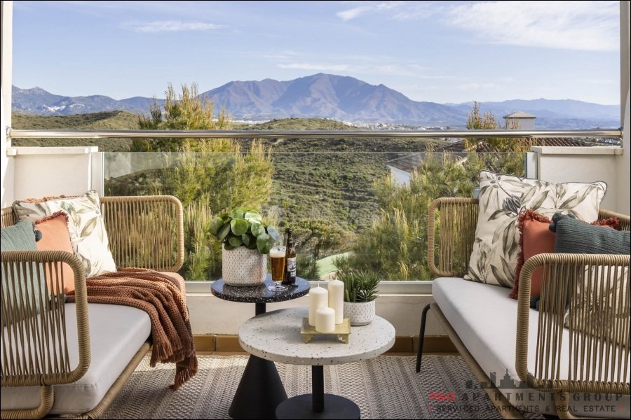
Apartamento STUPA HILLS - Benalmadena - Costa del Sol - Spagna
Benalmádena Benalmádenada 250EUR al giorno -
 Lussuoso
Apartamento EL MIRADOR DEL SALTILLO IV - Torremolinos - Malaga - Costa del Sol - Spagna
Torremolinos Saltilloda 179EUR al giorno
pubblicità